Who is the tool for?
• Citizens
• Urban authorities
Type of solution

• Software-based
•Infrastructure
Objective
• Social development
Maturity level
• Ready to adapt & replicate
Why is it used?
- Citizens or tourists with disabilities, as well as elderly people and families with prams, want on-site-surveyed accessibility information in urban and logistical contexts.
- A small/medium-sized city wants to provide citizens and tourists with georeferenced POIs containing information on inclusive barrier-free use.
How is the tool used by the recipient?
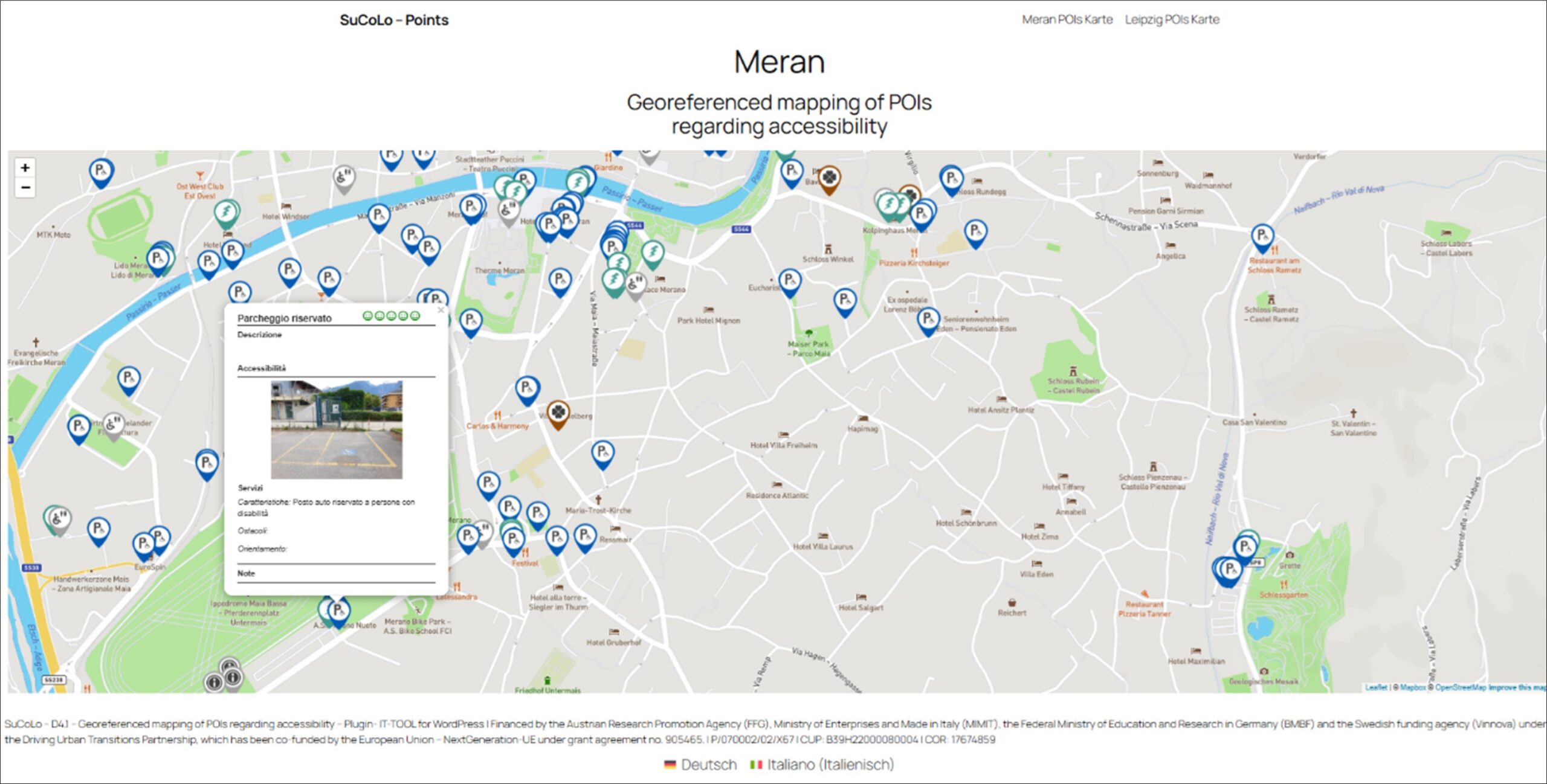
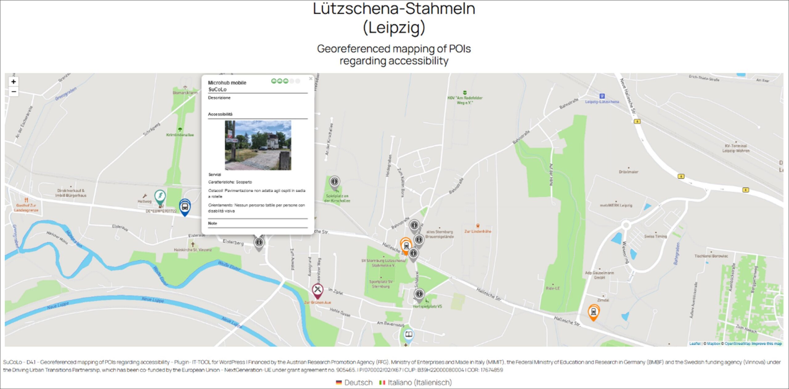
Recipients use the interactive, responsive map—accessible from home or on the go—to view locally verified accessibility information for key points of interest in the area.
Which problem is solved?
Addressing the lack of accessible, detailed, and reliable information on points of interest, this solution provides digital, georeferenced, interactive maps showing the position and accessibility of locations. Using the IG-VAE methodology, it delivers objective, factual descriptions – including photos and supplementary data -allowing users, including families with prams and senior citizens, to assess whether a site meets their individual accessibility needs.
Links to more information
You can find more background on the development on the mapping tool here: D4.1
- Georeferenced mapping Merano: https://sucolo.independent.it
- Georeferenced mapping Leipzig: https://sucolo.independent.it/lipsia
Which partners developed the tool?
independent L. Soc. Coop. ONLUS – Merano (BZ – Italy)
How was the tool developed
“POIs or nearby locations that have functional, social or economic relevance to users of the hub were located and assessed. Each POI was classified (e.g., as a participant business, parking space, etc.) and evaluated according to accessibility attributes such as level of accessibility compliance, barriers and available services in an interactive map. Namely, in 4 stages:
- Programming IT tool for WordPress (D4.1)
- On-site survey and data entry POIs
- Translation of content
- Assessment of accessibility level