Software prototype for routing and scheduling delivery orders

Screenshot of a route planning software interface with a map in the background and several highlighted controls and explanatory labels, such as selecting a depot, generating shipments, vehicle numbers, and calculating routes.
Screenshot of route planning software showing a map with visualized delivery routes for multiple vehicles. Marked routes, stops, and a sidebar display detailed route information and individual delivery steps.
Screenshot of route planning software showing a map with a long continuous delivery route and many marked stops. At the top are controls for generating shipments and selecting vehicles, and on the right a sidebar with detailed route information and individual delivery steps.

Who is the tool for?

Who is it for?

• Logistics providers
• Retailers​

Type of solution

Type of solution

• Software-based
Infrastructure

Objective 

Objective

​​• Economic development​

Maturity level

• Pilot

Why is it used?

  • ​​A courier company aims to optimize last-mile cargo delivery by improving route calculation, vehicle routing, and shipping planning. 
  • A bicycle courier service aims to make last-mile delivery in urban outskirts more sustainable by increasing delivery efficiency, reducing travel times, and accounting for factors specific to bicycle transport. 

How is the tool used by the recipient? 

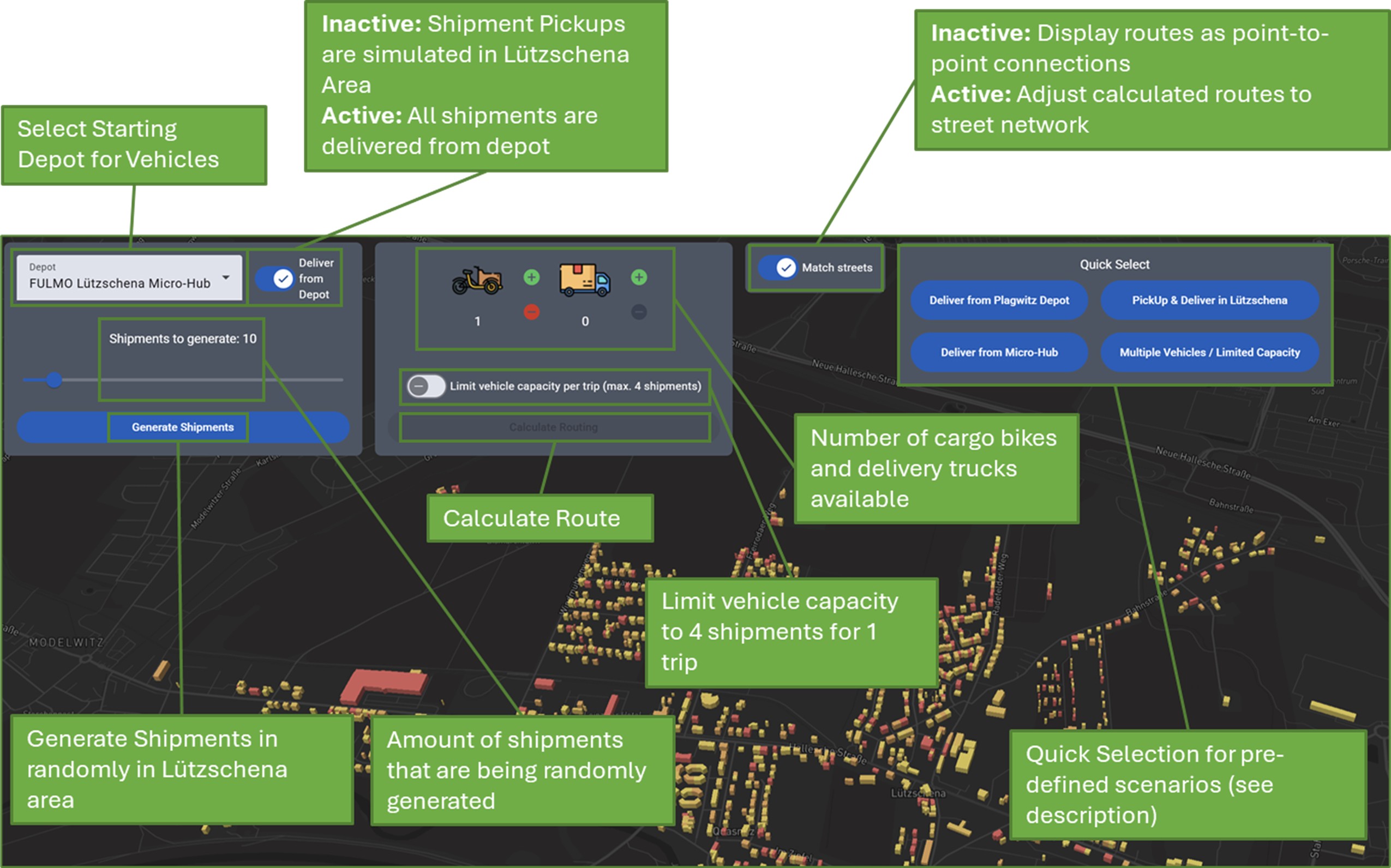
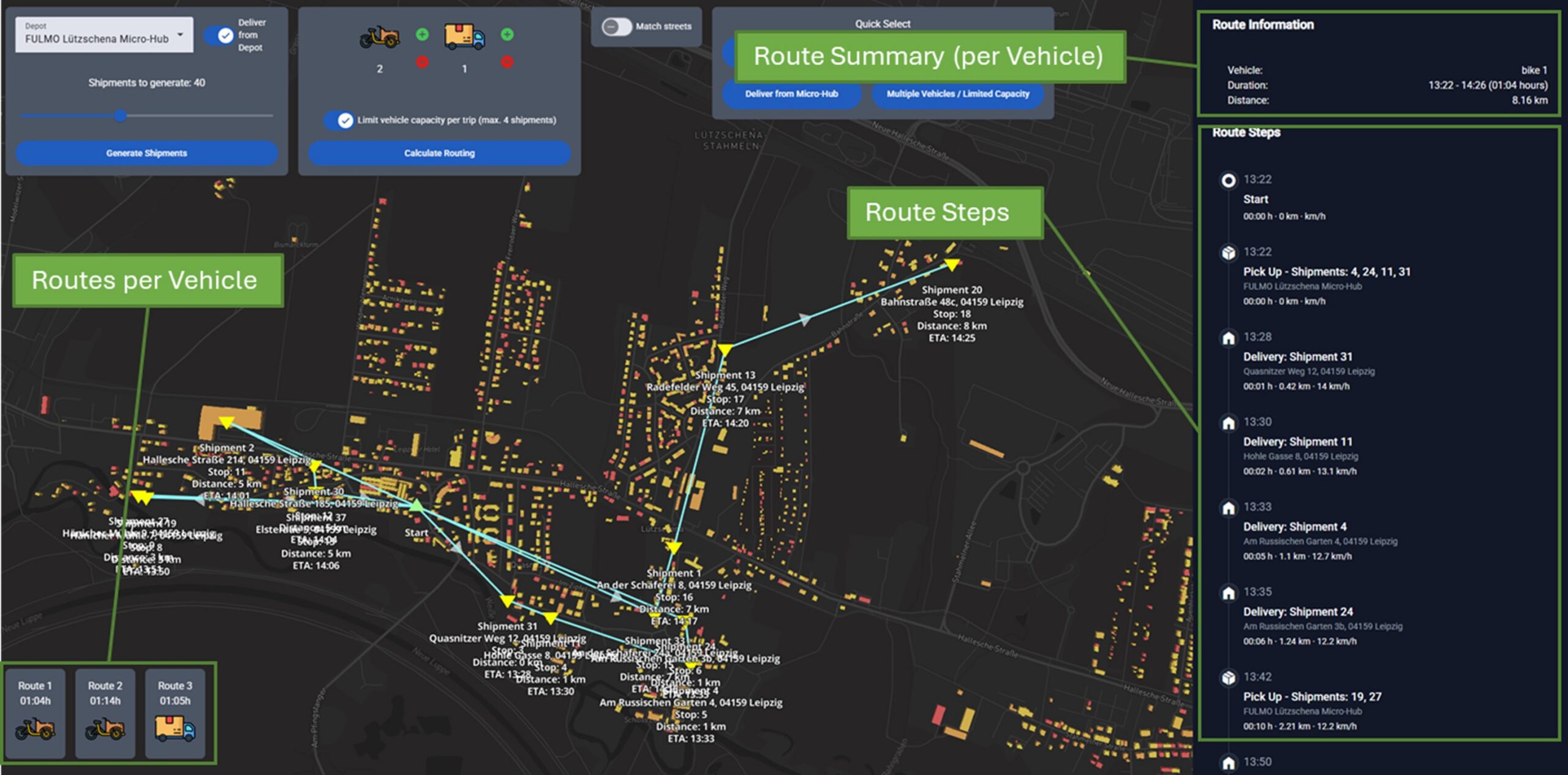
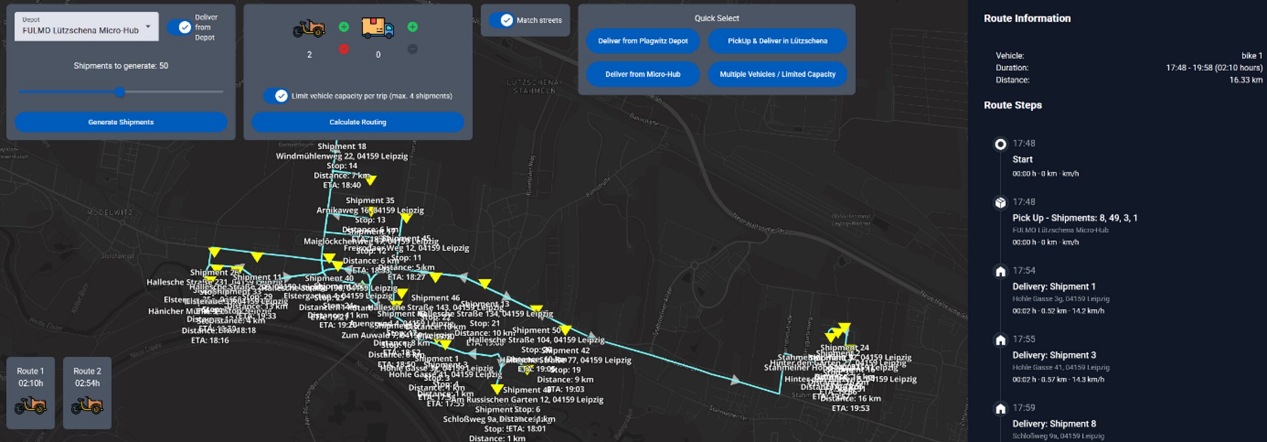
​​The tool is web-based and can be opened via a website. ​ 

Which problem is solved?

​This prototype contributes to the goal of supporting bicycle and mixed fleet delivery services in optimizing their delivery routes and planning their orders, using only open-source software.​ 

Which partners developed the tool?

​Leipzig University, Logistics Living Lab​ 

How was the tool developed

  • ​​Identifying problems in urban outskirts​ (D2.1, D2.2, D2.4
  • Identifying available open data sources​ 
  • Identifying user needs​ 
Scroll to Top