Who is the tool for?

• Urban authorities
• Logistics providers
• Retailers
Type of solution

• Software-based
•Infrastructure
Objective

• Accessibility by design
Maturity level
• Pilot
Why is it used?
- Urban city planning wants to identify potential barrier-free locations in urban outskirts for certain facilities.
- An urban logistics provider want to identify potential locations for a micro-hub or accessible pick-up station on an outskirt.
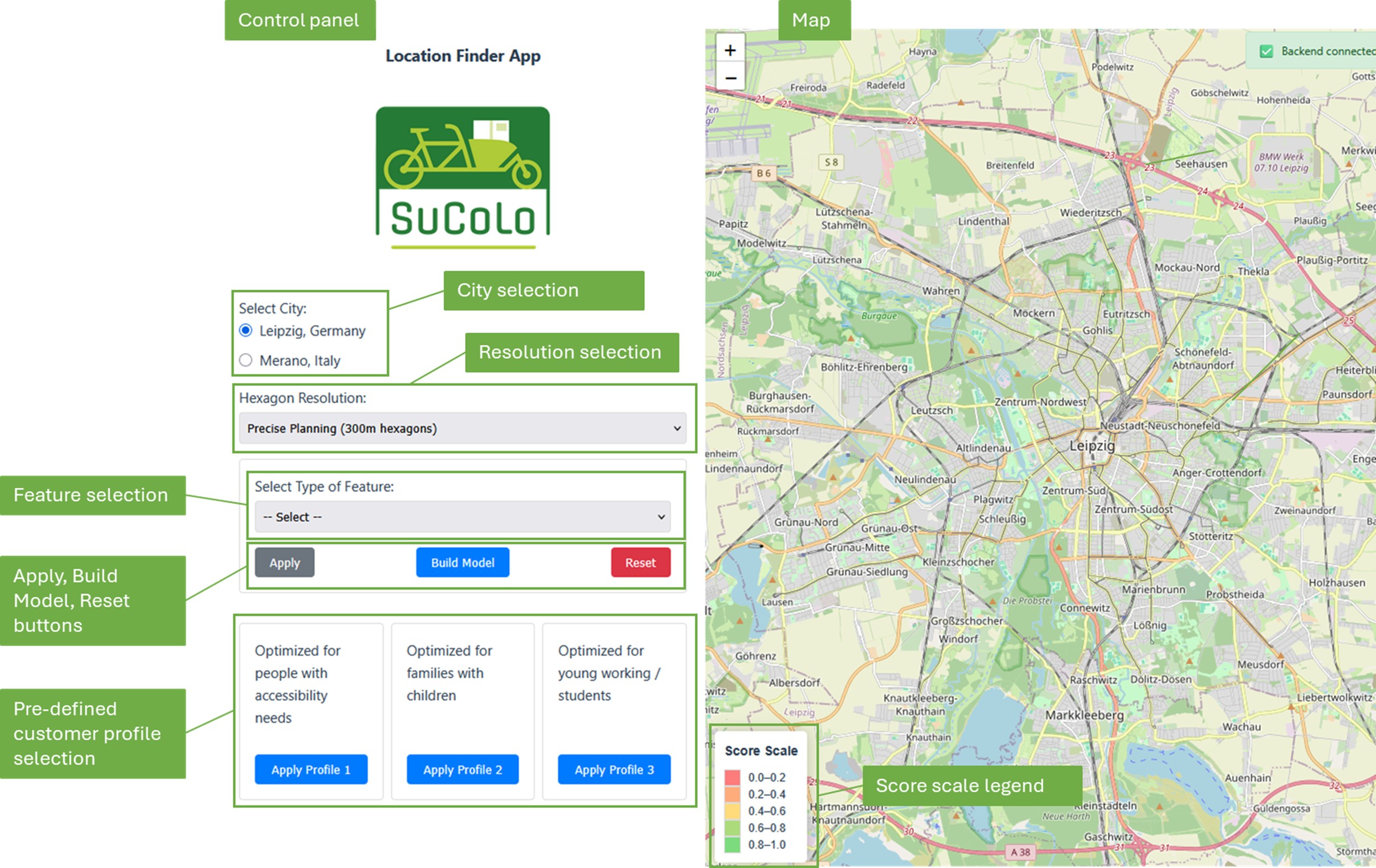
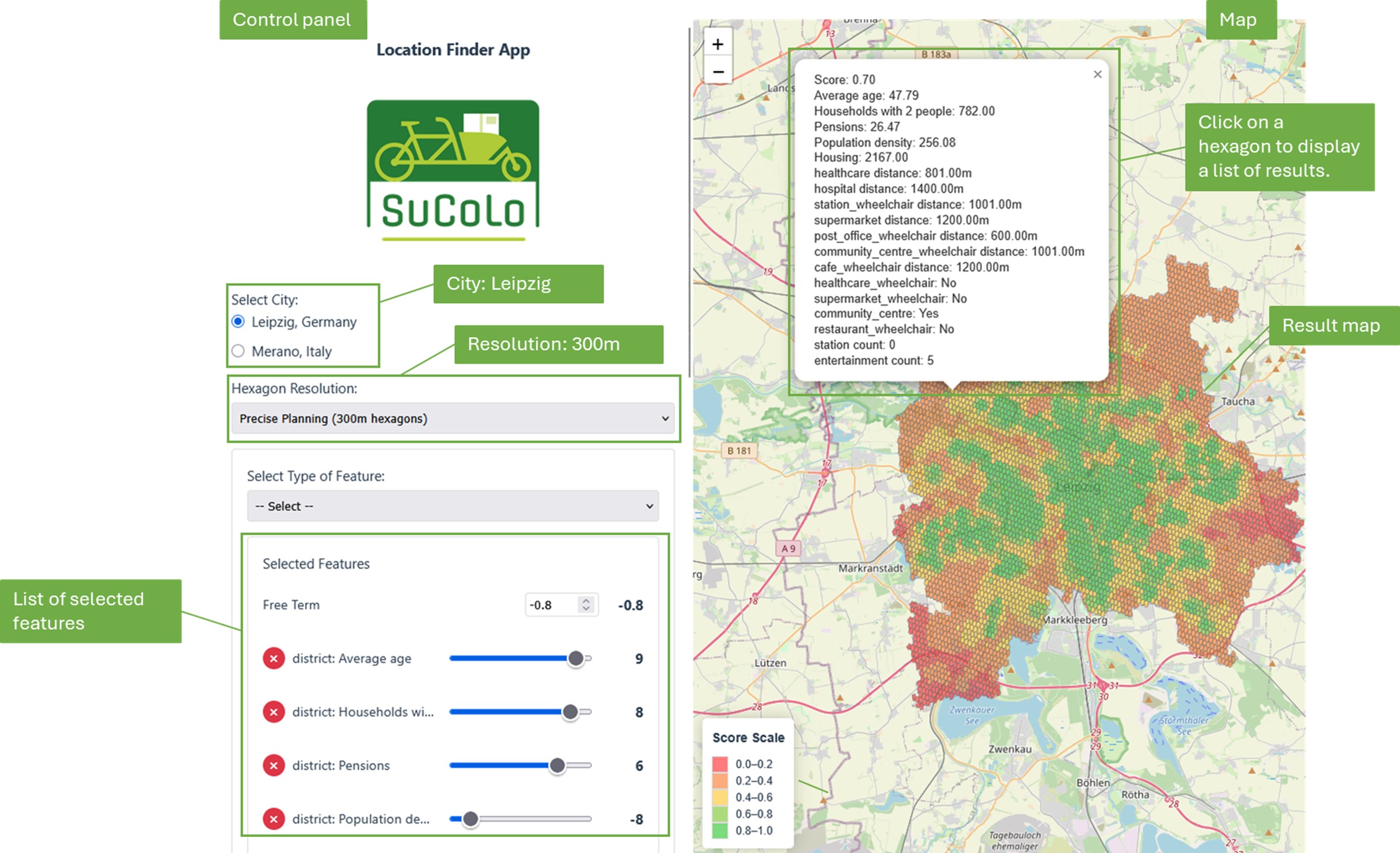
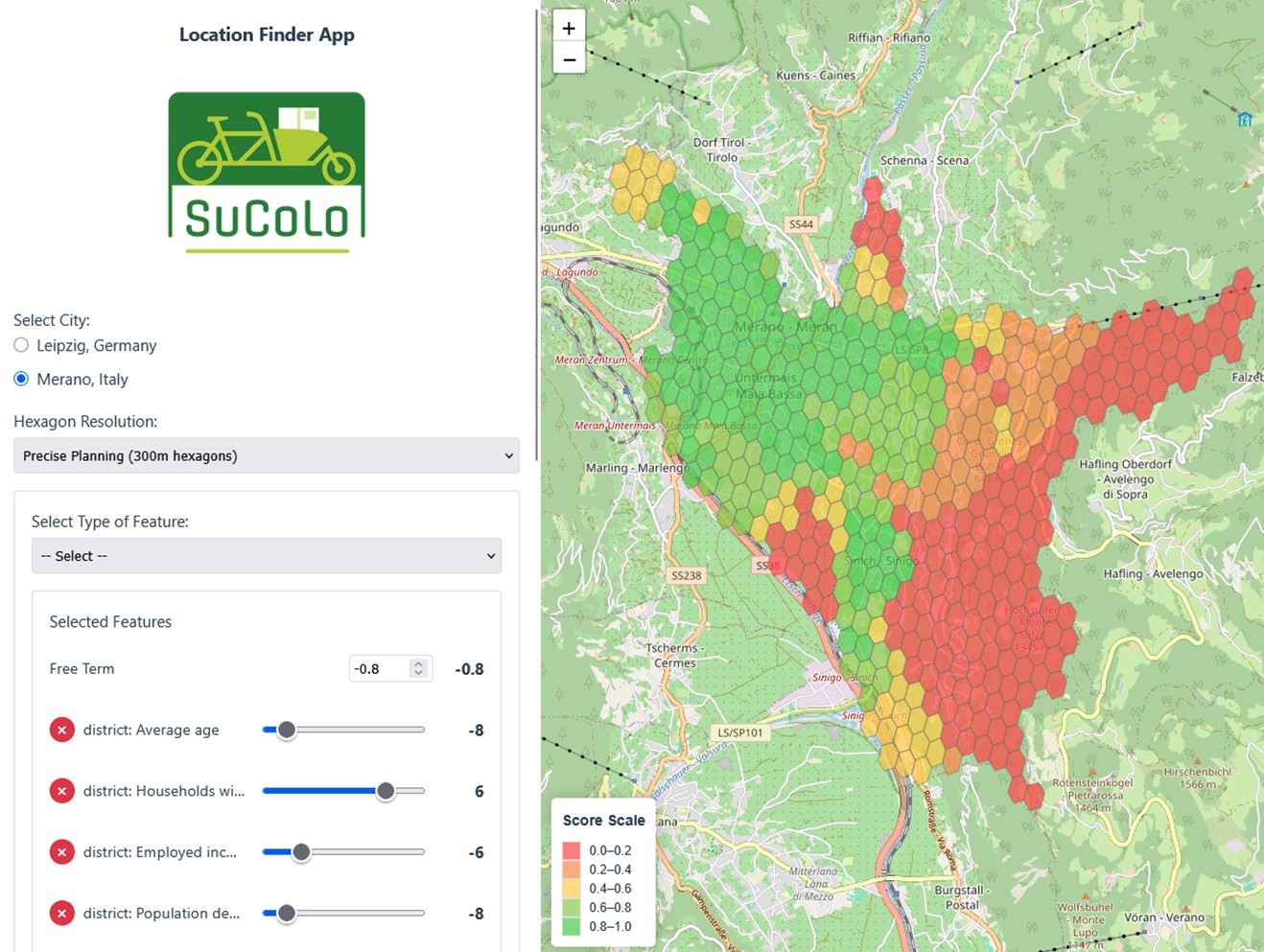
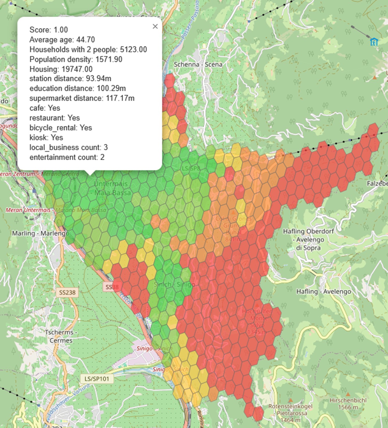
How is the tool used by the recipient?
- Identifying problems in urban outskirts (D2.1, D2.2, D2.3)
- Identifying available open data sources
- Identifying customer needs
Which problem is solved?
The aim is to develop a user-oriented, simulation-based decision support model focusing on sparsely populated areas and accessibility.